Valle del Sarca bike Path

Long distance cycling • Garda Trentino and Valle di Ledro

Long distance cycling recommended route Long distance cycling  · Garda Trentino

Lakes Cycle Route

Responsible for this content
VisitTrentino Verified partner 
  • GardaTrentino-ValledeiLaghi-Toblino_FabioStaropoli_47128
    GardaTrentino-ValledeiLaghi-Toblino_FabioStaropoli_47128
    Photo: VisitTrentino
Map / Lakes Cycle Route

Selected alternatives for you
    The Valle dei Laghi cycle-pedestrian path starts from the shores of Lake Garda and goes up the Valle dei Laghi from which it takes its name.
    moderate
    Distance 37.3 km
    3:15 h
    471 m
    118 m
    494 m
    68 m
    Lakes, vineyards, flavors, and castles. The Lakes route is a ribbon that immerses you in the history and culture of the Trentino area.
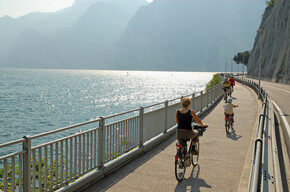
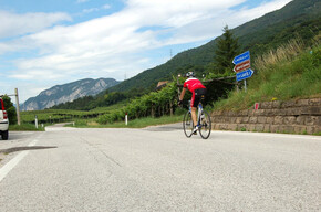
    This route allows you to follow the course of the Sarca river for about 40 km, starting from the shores of Lake Garda, up to the lake basins of Cavedine, Santa Massenza, Toblino.
    Profile picture of VisitTrentino
    Author
    VisitTrentino
    Responsible for this content
    VisitTrentino  Verified partner 
    Difficulty
    moderate
    Overall difficulty
    moderate

    Derived from the technical difficulty and the stamina requirements.

    Experience
    Landscape
    Highest point
    494 m
    Lowest point
    68 m
    Best time of year
    Jan
    Feb
    Mar
    Apr
    May
    Jun
    Jul
    Aug
    Sep
    Oct
    Nov
    Dec

    Track types

    Asphalt 83.57%Dirt road 5.69%Forested/wild trail 0.25%Path 1.96%Road 8.51%Unknown 0%
    Asphalt
    31.2 km
    Dirt road
    2.1 km
    Forested/wild trail
    95 m
    Path
    733 m
    Road
    3.2 km
    Unknown
    1 m
    Show elevation profile

    Safety information

    As you can imagine, the passability of routes in a mountain environment is closely linked to current conditions and therefore depends on natural phenomena, environmental changes, and weather conditions. For this reason, the information contained in this sheet may have changed. Before setting off, check the status of the route by contacting the manager of the refuges on your route, alpine guides, visitor centers of natural parks, and tourist offices.

    Roadbook

    The first section of the cycle path, closely following the Sarca river, leads from the mouth towards Arco. It is a delightful town located at the foot of the Rupe, on which the ruins of the homonymous Castle stand. Arco is a spa town famous since the nineteenth century, a holiday resort of the Habsburg nobility.

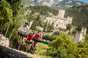
    Crossing the town, the path climbs again along the river up to the village of Ceniga. Reaching the northern outskirts of Dro on low-traffic roads, you take the cycle-pedestrian path leading to Pietramurata, from where a branch starts that reaches Lake Cavedine, and then finally Sarche, crossing the splendid and solitary landscape of the Marocche.

    Once in Sarche, there are several options: for those who want to cycle more, you can climb towards the Giudicarie with a section of about 6 km that also crosses the spectacular Limarò gorge and ends near the Servi bridge, at the entrance to Ponte Arche, or you can climb towards Lake Terlago, passing through the village of Vezzano. In both cases, the uphill climb should not be underestimated.

    Alternatively, in the summer months, you can use the bike bus service returning to Trento. 

    Rest stop
    Tip
    Nearby
    Top Partner
    Waypoint
    Start point
    End point
    Low point
    High point
    Forecast
    Today {low} to {high} and {precipitation} of {precipitation_type}
    show {x} more
    Photo
    Video
    Spiaggia Lido Blu - Villa Cian
    Chiesa di San Rocco
    Palazzo Marchetti o di San Pietro
    Collegiata di Santa Maria Assunta
    Galleria Civica Segantini
    Chiesa di Sant’ Apollinare
    Eremo di San Paolo
    Chiesa di Sant' Antonio
    Chiesa dell’Immacolata
    Centrale Fies
    Sarche di Lasino
    Casa Caveau Vino Santo
    Bus dei Poieti
    Pozzi Glaciali
    BIODISTRETTO DELLA VALLE DEI LAGHI
    Pannello 4- Terlago Sketch Tour
    Pannello 6- Terlago Sketch Tour
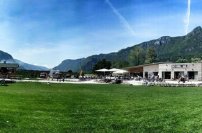
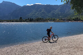
    Spiaggia di Terlago
    Pannello 3- Terlago Sketch Tour

    Public transport

    In summer, there is a bike bus service from Sarche to go up towards the Giudicarie Valleys and towards Trento.

    Directions

    Lake Garda is accessible both from the south and north via the state road SS 12 of the Brenner or the A22 motorway (exit Rovereto Sud/Lago di Garda Nord, 15 km from the tollbooth) continuing then on the state road SS 240. Those coming from Trento, as an alternative to the motorway, can take SS 45/bis. Coming from the south of Lake Garda, you can take SS 249.

    Coordinates

    DD
    45.874834, 10.872827
    DMS
    45°52'29.4"N 10°52'22.2"E
    UTM
    32T 645343 5081846
    w3w 
    ///uncanny.furnace.argument
    Get there by train, car, bike, or on foot!

    Similar routes nearby

    • Vallagarina Experience Bike Tour
    • From Rovereto to Nomi with your bicycle
    • Along the Marzemino wine route
    • Cycling among wineries and castles
    • Cycling around Rovereto
     These suggestions were generated by our system
    Difficulty
    moderate
    Overall difficulty
    moderate

    Derived from the technical difficulty and the stamina requirements.

    Distance
    37.3 km
    Duration
    3:15 h
    Ascent
    471 m
    Descent
    118 m
    Highest point
    494 m
    Lowest point
    68 m
    Refreshment stops available Cultural/historical interest Flora Insider tip Linear route

    Weather at the starting point

    10-day forecast

    Statistics

    • Content
    • Show images Hide images
    Features
    2D 3D
    Maps and trails
    Nothing selected - click and drag in the elevation profile to zoom
    Distance
    Duration
    Ascent
    Descent
    Elevation profile


    You may also like ...

    23 results
    LA MOSERISSIMA - Historical bicycle race of Trento

    LA MOSERISSIMA - Historical bicycle race of Trento

    Val Rendena Bike Path

    Val Rendena Bike Path

    Mori-Torbole bike path

    Mori-Torbole bike path

    Valle dell'Adige Nord Cycling Path

    Valle dell'Adige Nord Cycling Path

    The Avisiane hills

    The Avisiane hills

    Visita al MUSE e sosta al Bici Grill!

    Visita al MUSE e sosta al Bici Grill!

    Valsugana Bike paths

    Valsugana Bike paths

    Cycling among  wineries and castles

    Cycling among wineries and castles

    LA MOSERISSIMA - Historical bicycle race of Trento

    The appeal of vintage bicycles will be centre-stage in a unique event...

    Read more ...

    Val Rendena Bike Path

    Read more ...

    Mori-Torbole bike path

    This track joins the Vallagarina to the area of Lake Garda, and is...

    Read more ...

    Valle dell'Adige Nord Cycling Path

    Read more ...

    The Avisiane hills

    Beautiful circular route (No. 5 on the tourist map), which begins in...

    Read more ...

    Visita al MUSE e sosta al Bici Grill!

    Read more ...

    Valsugana Bike paths

    Also called “La via del Brenta”, this is one of the most...

    Read more ...

    Cycling among wineries and castles

    Between wineries and castles on your two wheels!

    Read more ...

    Long distance cycling