"Il lago d'erba della Val Lomasona" path
Hiking with kids
"Il lago d'erba della Val Lomasona" path
From the village of Dasindo, follow the signs to val Lomasona, enter the valley as far as the junction a little before the fish farm. You can leave the car here, on the side of the road. On the left you will find the wooden notice board and the start of the path which flanks the Torbiera Lomasona provincial natural park.
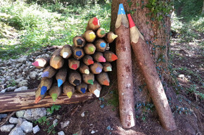
<p>A family excursion through Val Lomasona. Along the way, you will find clues left by the protagonists of this story.</p> <p>The route is signposted with wooden signs.</p>
"Il lago d'erba della Val Lomasona" path

Garda Trentino Verified partner
-
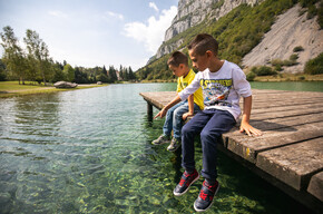
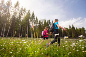
 Family on the pathPhoto: APT Terme di Comano Dolomiti di Brenta, North Lake Garda Trentino
From the village of Dasindo, follow the signs to val Lomasona, enter the valley as far as the junction a little before the fish farm. You can leave the car here, on the side of the road. On the left you will find the wooden notice board and the start of the path which flanks the Torbiera Lomasona provincial natural park.
A family excursion through Val Lomasona. Along the way, you will find clues left by the protagonists of this story.
The route is signposted with wooden signs.
Author’s recommendation
Along the Little Walkers’ Paths, walking is like entering fairy tales.
Garda Trentino Verified partner
Derived from the technical difficulty and the stamina requirements.
Track types
Safety information
The telephone number for the emergency services is 112.
The information on this chart is subject to inevitable variations, so this means that none of the indications are absolute. It is not entirely possible to avoid giving inexact or imprecise information, given how quickly environmental and weather conditions can change. For this reason we decline any responsibility for changes which the user may encounter. In any case, the hiker is advised to check the conditions of the places, environment and weather before setting out.
Tips and suggestions
You’ve picked the perfect trail – now make sure you’re ready to enjoy it to the fullest. Local hiking specialists are here to help: guides, shops and experts with the tips and support you need for every step of the way.Roadbook
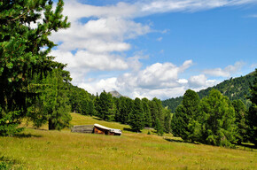
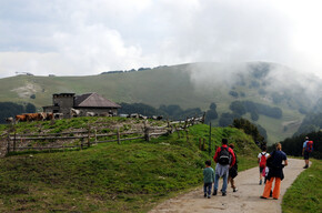
The path flanks the Torbiera Lomasona, a veritable “lake of grass” created from an ancientpond of free water and interrupted by small canals and wells. Torbiera is a provincial natural reserve, a particular protected habitat where various types of amphibians and reedand marsh birds live. Above the first part of the path there are rocks with numerous cavesand which maybe gave rise to the local legends that talk of witches. The path enters the wood, where there are black hornbeams, flowering ash, spruce and beech trees, somereally monumental, and then continues beyond the narrow Dal stream until the final part ofthe wood before returning along the gravel path.
Public transport
The area around Lomaso is connected by the intercity bus line 211 (Riva del Garda - Tenno - Fiavè - Ponte Arche) to the other places in Garda Trentino.
Up-to-date information on timetables and routes.
Get Timetable to destination
Directions
From Ponte Arche/Comano Terme go in the direction of Fiavè; when you arrive in the villlage of Dasindo (4 km far from Ponte Arche) enter the village and keep going towards Val Lomasona.
Find out how to reach Garda Trentino.
Parking
Free parking in Val Lomasona (near the fish-farming building).
Coordinates
Book recommendation by the author
.
Author’s map recommendations
Garda Trentino TREKKING Map – Available in the info points of Garda Trentino (Riva del Garda, Arco, Torbole sul Garda, Ledro, Comano Terme)
Equipment
This excursion is quite simple and presents no particular difficulty. However, we still recommend you to wear suitable footwear, a hat, sun screen and sunglasses. And be sure to bring water!
Localization
Derived from the technical difficulty and the stamina requirements.
Weather at the starting point
Statistics
You may also like ...