Falesia Cascata di Tret - 19 vie dal 5a al 6c+
Alpine climbing • Val di Non
Falesia Cascata di Tret - 19 vie dal 5a al 6c+
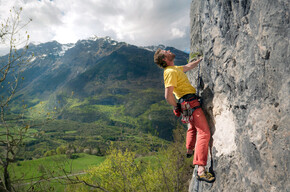
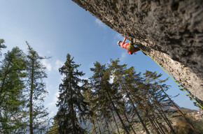
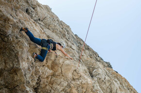
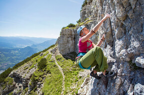
Le 19 vie dalla chiodatura ottima sono di difficoltà compresa tra il 5a e il 6c+ e si trovano al fresco della Cascata di Tret.
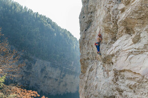
La falesia ha una base comoda ed è facilmente raggiungibile grazie al sentiero che porta alla cascata. L'ambiente è molto piacevole e il suono dell'acqua accompagna l'arrampicata. La falesia permette di arrampicare sempre al fresco anche nelle giornate più calde.
Tret Falls Crag - 19 routes from 5a to 6c+

APT Val di Non Verified partner
-
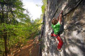
 Photo: Silvia Gentilini, APT Val di Non
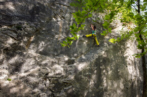
Author’s recommendation
APT Val di Non Verified partner
Derived from the technical difficulty and the stamina requirements.
Track types
Show elevation profileSafety information
Correct equipment, helmet use, the right skills and a high threshold of alertness are essential for practicing this sport.Roadbook
It is divided into two sectors: the first sector is vertical limestone rock with horizontal holds, and the second sector is also vertical limestone rock with overhanging sections with handholds similar to climbing in the Dolomites.
TRAIL SECTOR
1 Diedrite, 15 m 5a
2 Viewpoint, 25 m 6b
3 Rosita, 25 m 6b/c
4 Masquenada, 22 m 6b
5 Lavaredo, 22 m 6b
6 Bark, 20 m 6a
7 So be it, 20 m 5c
8 Giuppo, 20 m 6a
WATERFALL SECTOR
9 Arthur, 25 m 6b+
10 Unstable glaciers, 25 m 6b+
11 9 1/2 weeks, 28 m 6c
12 Armed Lands, 30 m 6b
13 Bus from the Piss, 30 m 6c+
14 The Hidden Frontier, 30 m 6c+
15 Fess vinatzer, 30 m 6°
16 White Fang, 35 m 6c
17 Cobra 11, 25 m 6c
18 Scorla everything, 30 m 6a+
19 No big ma pig, 30 m 6b
Public transport
Public-transport-friendly
SAD company bus 246 connects Fondo to the hamlet of Tret and then porseguire to MeranoDirections
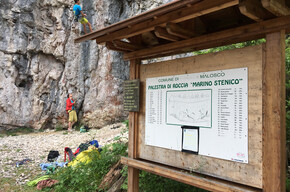
From the center of the hamlet of Tret, one heads toward the Aurora Hotel. just beyond the hotel, one notices signs to the left for the base of the waterfall, which can be reached in only a 15-minute walk.Parking
There are parking spaces in the center of the village.Coordinates
Equipment
A 70-meter rope is required.Localization
Derived from the technical difficulty and the stamina requirements.
Weather at the starting point
Statistics