GARDECCIA - VAJOLET AND PREUSS REFUGES - PRINCIPE PASS - ANTERMOIA PASS - ANTERMOIA REFUGE - VAL DURON - CAMPITELLO
Mountain tour • Val di Fassa
GARDECCIA - VAJOLET AND PREUSS REFUGES - PRINCIPE PASS - ANTERMOIA PASS - ANTERMOIA REFUGE - VAL DURON - CAMPITELLO
High-level hikes
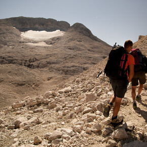
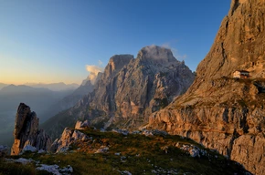
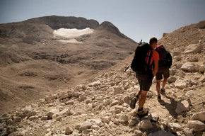
Take the cable car to Ciampedìe and from there the path no. 540 (45 mins to add to total time) or the chair lifts from Pera di Fassa (20-25 mins to add to total time).From Gardeccia go along the wide dirt road marked path no. 546 up to the Vajolet and Preuss refuges at 2,243 m (1 hour).Next take path no. 584 which climbs up into the upper Vaiolét valley. As you walk, the Catinaccio d’Antermoia (Ciadenac de Antermoa) mountain (3,002 m) becomes increasingly imposing, and eventually you will reach the Passo Principe refuge (2,597 m), which as the name suggests is on the pass (1 hour; 2 hrs).Take the path to the right and climb up by the base of the Catinaccio d’Antermoia (Antermoa). The path is a steep zigzag and soon brings you to the Passo di Antermoia (Antermoia Pass) (2,770 m) (30 mins; 2 hrs 30).Down the other side is the valley of Antermoia with its lake. Legend tells that the witches of Fassa would meet here. At the end of the valley is the Antermoia refuge at 2,497 m (45 mins; 3 hrs 15). Now you take path no. 580 to the Passo Dona (Dona Pass; 2,516 m) and descend to the Val di Dona, first over the scree and then grass. Leave path no. 580 which goes down to Mazzin (Mazin) through the Val Udai, keep left on path no. 578 and cut diagonally across to the Passo delle Ciaregole (Ciaréjoles Pass; 2,282 m).On the other side of the pass is the Val Duron, and the valley floor is reached by way of a path of black volcanic rock which then takes you through an alder wood. Cross the stream at the bottom and turn right on path no. 532 towards the Baita da Lino Brach and then the Micheluzzi refuge at 1,850 m (1 hour 45; 5 hrs).To get to Campitello (Ciampedèl) avoiding in part the busy dirt road, you can take an alternative path. Go downhill from the refuge and cross the stream Ruf de Duron and then go uphill on the opposite bank for 20 metres.Then turn left onto a flat path which is equipped with picnic tables. The path will join the Val Duron dirt road at Pozates, with the reastaurant Baita Fraines, after a fairly steep descent.Follow it now for the rest of the distance to Campitello (45 mins; 5 hrs 45).

