Passo del Tonale

Race cycling • Val di Sole

Race cycling Race cycling  · Val di Sole, Pejo e Rabbi

Passo del Tonale

Responsible for this content
VisitTrentino Verified partner 
  • Passo del Tonale
    Passo del Tonale
    Photo: VisitTrentino, VisitTrentino
Map / Passo del Tonale

Selected alternatives for you
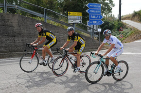
    On the road of the White War. The climb up Passo del Tonale is full of history. 15 kilometres that show the signs of the battle fought at prohibitive heights on a border so difficult to control.
    moderate
    Distance 15.1 km
    2:23 h
    1,078 m
    161 m
    1,882 m
    960 m
    Profile picture of VisitTrentino
    Author
    VisitTrentino
    Responsible for this content
    VisitTrentino  Verified partner 
    Difficulty
    moderate
    Overall difficulty
    moderate

    Derived from the technical difficulty and the stamina requirements.

    Experience
    Landscape
    Highest point
    1,882 m
    Lowest point
    960 m
    Best time of year
    Jan
    Feb
    Mar
    Apr
    May
    Jun
    Jul
    Aug
    Sep
    Oct
    Nov
    Dec

    Track types

    Show elevation profile

    Safety information

    Please note that the practicability of the itineraries in a mountain environment is strictly linked to the contingent conditions and is therefore influenced by natural phenomena, environmental changes and weather conditions. For this reason, the information contained in this page may have changed. Before leaving for a tour, make sure the path you will approach is still accessible by contacting the owner of the mountain hut, the alpine guides or the visitor centres of the nature parks, the info offices of the local tourist board.

    Roadbook

    Passo del Tonale had a strategic role for both the Austrian defence and the Italian attacks. Today it is the link between Val di Sole and upper Val Camonica. The road to reach the pass rises from Ossana in val di Sole. The start is at the crossroads to Pejo. The difference in height is about 900 metres with an average slope of 6 percent. The climb runs smooth for about two kilometres, then at the entrance of the town of Vermiglio, the slope becomes more strenuous. This is the most tiring stretch. Leaving the village of Fraviano, the valley narrows and in summer, the forest provides cool air and shade. After having climbed 9 kilometres, on the left you can see the traces of the Great War: Fort Strino. Continuing the climb, you reach a more strenuous stretch about a kilometre long. Then the slope drops slightly. The view of the Presanella glacier accompanies the last two kilometres that are a comfortable ride. The slope is just over 3 per cent and in a few minutes you reach the top of the pass where we find the War Memorial: a crypt that preserves the burial recesses of the fallen. On the sides you can admire one of the most important ski resorts of the Alps, halfway between Trentino and Lombardia. The Giro d’Italia has passed on this road in several editions. In 2010 it was a stage finish. Swiss cyclist Johann Tschopp won the stage. He broke away from the pack on the Gavia with Gilberto Simoni, during the last Giro in which the champion from Trentino took part.
    Rest stop
    Tip
    Nearby
    Top Partner
    Waypoint
    Start point
    End point
    Low point
    High point
    Forecast
    Today {low} to {high} and {precipitation} of {precipitation_type}
    show {x} more
    Photo
    Video

    Coordinates

    DD
    46.312890, 10.737180
    DMS
    46°18'46.4"N 10°44'13.8"E
    UTM
    32T 633752 5130279
    w3w 
    ///dimension.stun.hipbone
    Get there by train, car, bike, or on foot!

    Similar routes nearby

    • Peio Fonti
    • Madonna di Campiglio
    • Pinzolo - Madonna di Campiglio - Campo Carlo Magno
    • Campiglio and Comano road bike route
    • Facile anello della Val di Non con salita a Rumo
     These suggestions were generated by our system
    Difficulty
    moderate
    Overall difficulty
    moderate

    Derived from the technical difficulty and the stamina requirements.

    Distance
    15.1 km
    Duration
    2:23 h
    Ascent
    1,078 m
    Descent
    161 m
    Highest point
    1,882 m
    Lowest point
    960 m

    Weather at the starting point

    10-day forecast

    Statistics

    • Content
    • Show images Hide images
    Features
    2D 3D
    Maps and trails
    Nothing selected - click and drag in the elevation profile to zoom
    Distance
    Duration
    Ascent
    Descent
    Elevation profile


    You may also like ...

    164 results
    Fai-Andalo della Paganella

    Fai-Andalo della Paganella

    Roadbike - Pergine Valsugana - Val dei Mocheni

    Roadbike - Pergine Valsugana - Val dei Mocheni

    Sellaronda

    Sellaronda

    Lavarone - Carbonare - Pedescala - Rotzo - Roana - Passo Vézzena -...

    Lavarone - Carbonare - Pedescala - Rotzo - Roana - Passo Vézzena -...

    Roadbike - Lakes Levico and Caldonazzo - and Tenna Hill

    Roadbike - Lakes Levico and Caldonazzo - and Tenna Hill

    Passo Manghen - Fiemme

    Passo Manghen - Fiemme

    Madonna di Campiglio

    Madonna di Campiglio

    Campionissimi - Palù di Giovo

    Campionissimi - Palù di Giovo

    Fai-Andalo della Paganella

    This route follows the Valle di Non state road on the outskirts of...

    Read more ...

    Roadbike - Pergine Valsugana - Val dei Mocheni

    Medium difficulty tour to discover the beautiful and green Valle dei...

    Read more ...

    Sellaronda

    The Sellaronda, or Tour of the Four Passes, is one of the most...

    Read more ...

    Lavarone - Carbonare - Pedescala - Rotzo - Roana - Passo Vézzena -...

    Read more ...

    Roadbike - Lakes Levico and Caldonazzo - and Tenna Hill

    Easy route, which allows you to admire the landscapes of the lakes of...

    Read more ...

    Passo Manghen - Fiemme

    The climb of Passo Manghen from Molina di Fiemme tells the story of...

    Read more ...

    Madonna di Campiglio

    In 2015, the Giro d’Italia arrived at Patascoss, starting point of...

    Read more ...

    Campionissimi - Palù di Giovo

    The big Champions ascent is the road leading from San Michele...

    Read more ...

    Race cycling